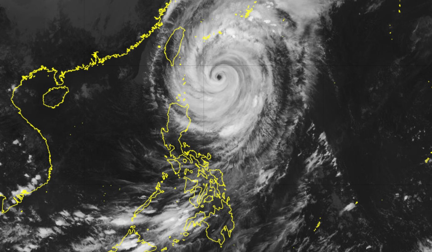
Typhoon Rosal, known internationally as Champi, was downgraded from super typhoon status on the afternoon of Thursday, October 22, according to Rappler. The Philippine Atmospheric, Geophysical, and Astronomical Services Administration (PAGASA) reported in its 5 pm bulletin that the storm's strongest sustained winds had fallen to 165 kilometers per hour, with gusts easing to 205 km/h.
At 4 pm on Thursday, the center of the typhoon was about 350 kilometers east of Itbayat, Batanes, traveling northwest at a slow 15 km/h. PAGASA said the storm would come closest to extreme Northern Luzon between Thursday afternoon and the morning of Friday, October 23.
Why it matters
Even in a weakened state, Rosal remains a serious rain threat for the country's northernmost provinces. Batanes is expected to receive 100 to 200 millimeters of heavy to intense rainfall within 24 hours, while Cagayan can expect 50 to 100 millimeters of moderate to heavy rain, per PAGASA.
The timing also matters. Rosal is the Philippines' 18th tropical cyclone of 2026 and the first of October. PAGASA had earlier projected that the country might see one or two cyclones during the month, so the season is tracking within expectations but still adding strain to communities that have already weathered a long run of storms.
Where the rain and winds are headed
Beyond Batanes and Cagayan, PAGASA warned that Rosal could bring rain and gusty winds to Ilocos Norte, Apayao, and Isabela on Thursday evening. The rest of the Cordillera Administrative Region, the remainder of Cagayan Valley, Ilocos Sur, La Union, and Aurora were told to expect scattered rain and thunderstorms.
The typhoon's trough, or outer extension, may also set off scattered rain and thunderstorms across Bicol, the Zamboanga Peninsula, Western Visayas, the Negros Island Region, Lanao del Norte, Misamis Occidental, and Palawan, according to the weather bureau.
PAGASA said Signal No. 3 could still be raised over Batanes, unless the storm's path shifts further to the north northwest. The northeasterly windflow, combined with the typhoon's outer bands, was also expected to deliver strong to gale-force gusts in several areas, and sea conditions were forecast to range from moderate to rough, with small vessels advised to take precautions or stay in port where possible.
A storm on its way out
Rosal entered the Philippine Area of Responsibility on Tuesday, October 20. It is projected to exit by Friday evening or early Saturday morning, October 24, and is likely to be downgraded to a severe tropical storm on Saturday once it is outside PAR, Rappler reported.
The storm arrives as the country shifts from the southwest monsoon, or habagat, which PAGASA declared over on October 5, toward the northeast monsoon, or amihan. The northeast monsoon usually ushers in colder surges, but PAGASA noted that this year's amihan period could be warmer than usual because the strong El Niño in the tropical Pacific is forecast to intensify into a very strong event in the final quarter of 2026.
That combination — a departing typhoon and an unusually warm monsoon transition — is one reason forecasters are watching both rainfall totals and temperature trends in the weeks ahead.
What to watch next: PAGASA's bulletins through Friday morning, when Rosal is expected to make its closest approach to extreme Northern Luzon, and whether Signal No. 3 is hoisted over Batanes.