Post-Tropical Cyclone Rachel was pushing north through the California desert early Sunday at roughly 25 mph, the National Hurricane Center said, after making landfall in northern Baja California the night before with maximum sustained winds near 60 mph.
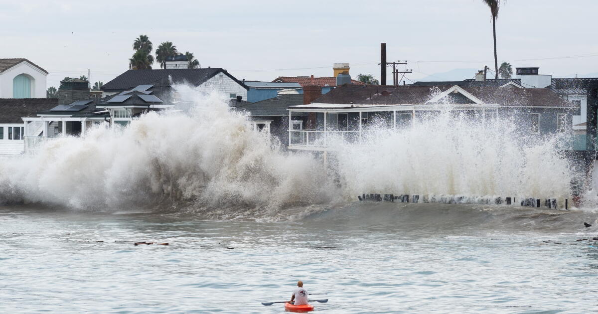
The storm's arrival capped a stretch of punishing weather across Southern California, where strong winds, heavy rain and coastal flooding forced evacuations, closed roads and damaged buildings, according to the Los Angeles Times. Forecasters said Rachel's top sustained winds had dropped to about 40 mph with stronger gusts, and the system was expected to keep weakening and break apart later in the day.
Why it matters
Tropical systems rarely reach California at tropical-storm strength. According to the Los Angeles Times, only two storms in the modern record have crossed the state at that intensity — one in September 1939 that struck Long Beach and San Pedro, killing 45 people from flooding and 48 more at sea, and Nora in September 1997.
The 1939 storm, sometimes called El Cordonazo, dropped 5.62 inches of rain on Los Angeles over three days and produced wind gusts up to 65 mph. Rachel's path through the region puts renewed attention on how prepared coastal infrastructure is for this kind of event — a question Long Beach officials raised directly as they surveyed the damage.
Long Beach braces as the peninsula takes another hit
The Long Beach peninsula, already worn down by weeks of heavy surf, faced fresh problems Sunday. City officials said waves had topped the bulkhead on Friday, sending water into homes and streets.
Mayor Rex Richardson said Saturday that inspectors had red-tagged eight buildings across 13 addresses, including apartment units, and yellow-tagged at least one more. A red tag means a building is unsafe to enter; a yellow tag limits how it can be used. Richardson told residents to treat the situation seriously and be ready.
Todd Leland, a manager in the city's Parks, Recreation and Marine Department, said the bulkhead and pedestrian boardwalk had already taken significant structural damage. Crews were reinforcing weakened sections with timber and thousands of sandbags to keep them from collapsing.
Richardson said the city's infrastructure was not built to withstand this level of impact. City Manager Tom Modica said he expected a long recovery and that Long Beach would seek help from the governor and possibly the federal government, adding that the disruption would likely last months rather than a single weekend.
A mandatory evacuation order covered homes on Seaside Walk between 64th and 66th places. It took effect at 7 p.m. Friday and was set to run through noon Tuesday. Officials said a commercial crane would place sandbags on 65th Place and westward, in front of addresses between 65th and 64th. The city also restricted the peninsula to nonresident traffic, with additional street closures beginning at 62nd Place.
High tides, flood watches and warnings across the region
The National Weather Service issued a flood watch for the mountains and deserts of Riverside and San Bernardino counties as well as San Diego County. Flash flood warnings were posted for areas including Dana Point, Indio, Palm Desert and El Cajon.
Forecasters warned that the morning high tide could bring more coastal flooding to San Diego, Newport Beach and Long Beach. At Newport Beach, high tide was forecast to reach 7.6 feet at 9:48 a.m., and the weather service's San Diego office said low-lying homes, businesses and some critical infrastructure could flood. Surf was expected to build to 6 to 9 feet, with the largest waves at south-facing beaches, especially in Orange County.
The water level at the Los Angeles Harbor tide gauge peaked at 7.7 feet Saturday morning, about 1.6 feet above the predicted tide, according to the weather service. The agency said projected high tides near 8 feet on Sunday morning would approach or exceed recent record levels for Los Angeles County.
Huntington Beach activated its emergency operations center on Friday. Crowds turned out Saturday morning to watch the heavy surf, and cyclists, walkers and runners filled the trail along Bolsa Chica State Beach. A stretch that had flooded Friday appeared to avoid further trouble Saturday despite posted "flooded" signs.
Rain spreads inland as the storm moves north
By 5 a.m. Sunday, the remnants of Rachel were rolling through the California desert, the National Hurricane Center said. The center described the system as moving north at about 25 mph and said that motion would continue as it traveled farther inland over the southwestern United States.
Rachel reached Baja California late Saturday night and was delivering strong winds and rain to parts of Mexico, Southern California and other areas of the Southwest. The National Weather Service said the region faced a strong chance of rain Sunday and Monday, with a slight chance of showers early Tuesday.
The weather service also noted that a Kelvin wave was approaching Southern California, a phenomenon that adds 6 to 12 inches to background sea levels and can persist for months. It does not break visibly on shore and may go unnoticed on its own, but it raises the baseline that storm surge and high tides build on.
Inland communities felt the effects as well. KESQ reported that Rachel drenched the Coachella Valley and that several roads were closed or affected by floodwaters. KLAS reported that the Las Vegas valley expected thunderstorms and strong winds from the storm, and NBC 7 San Diego reported that San Diego was preparing for flooding as the system approached.
What to watch next: whether Sunday morning's high tide pushes water into low-lying areas at levels matching or surpassing Los Angeles County records, and how quickly Long Beach's damaged bulkhead can be stabilized before the next round of surf.